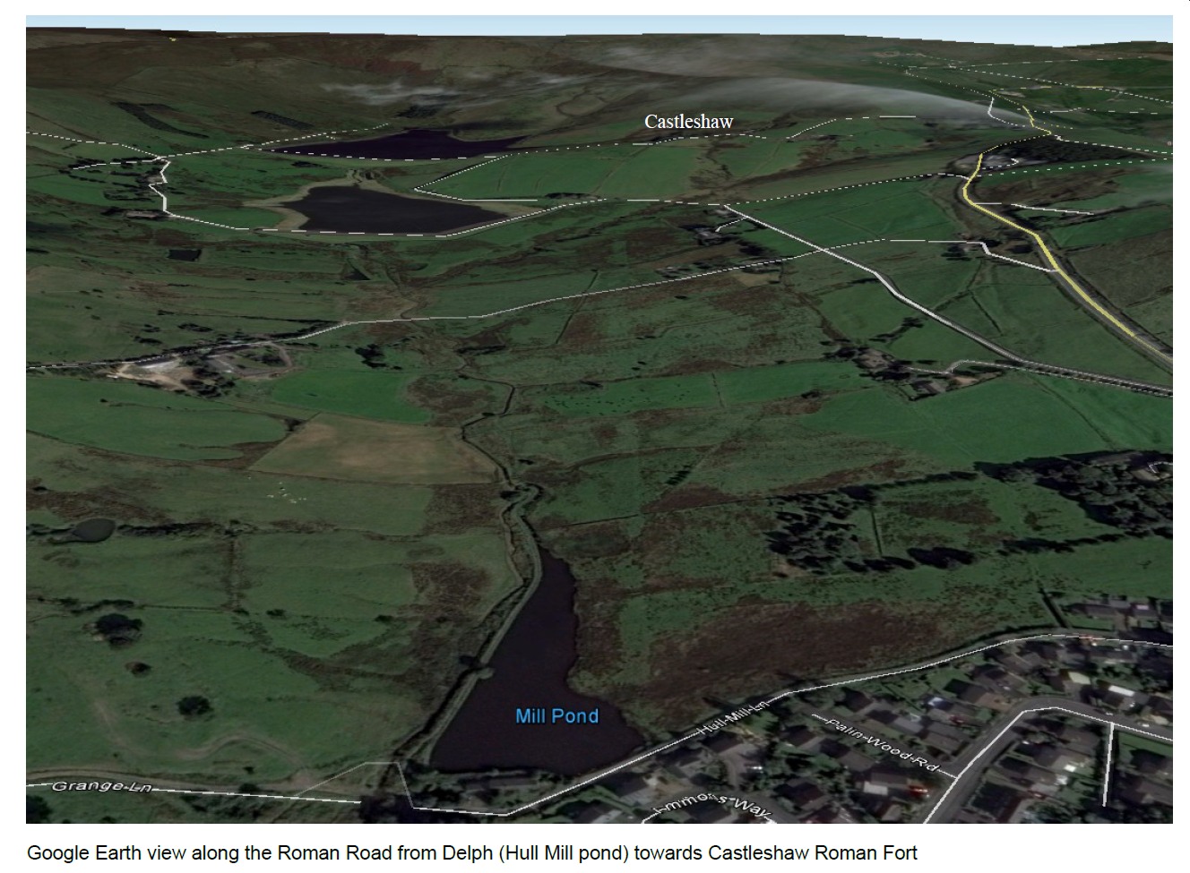
It emerges from the south side of Hull Mill dam and crosses the fields in the valley (Causeway Sett) on a slight raised bank (Agger) behind the Castleshaw centre towards the stream at Waters Clough.
The road is much harder to see in the fields adjacent to the fort but approaches the viewer just to the south of the fence.
Click on an image to view it in its own page
|
|
|
|
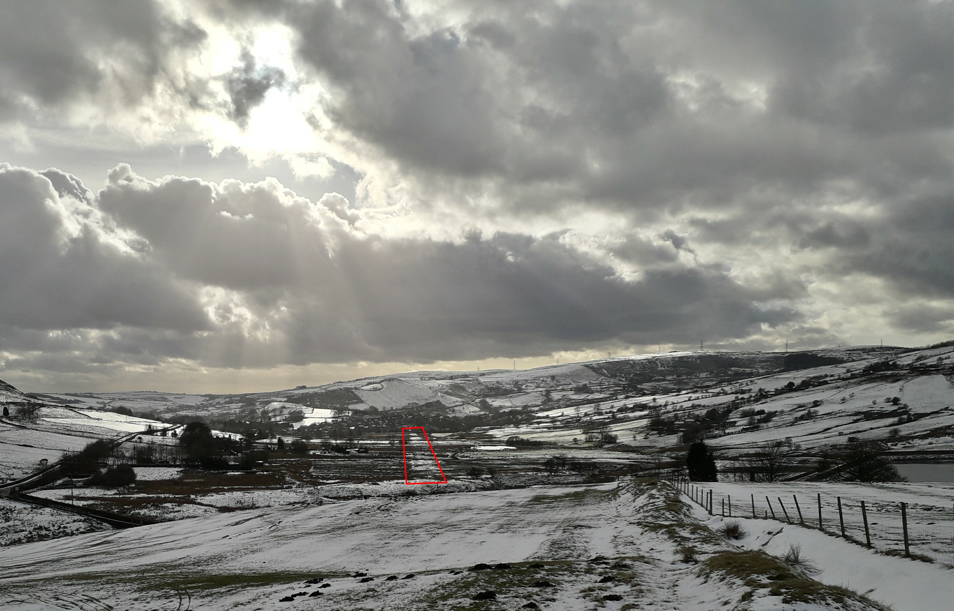
The snow highlights the road coming from Delph
towards the fort. |
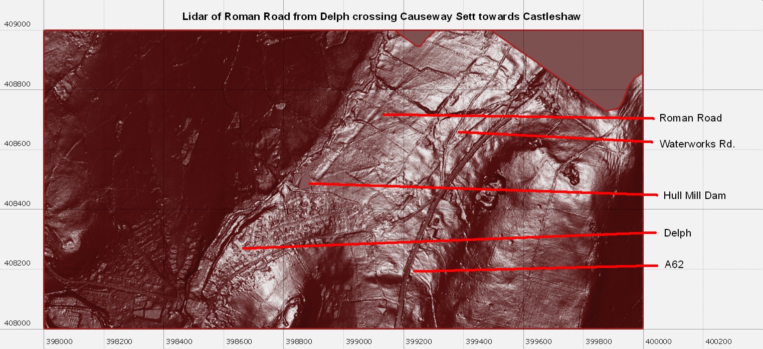
| The Lidar data is publically available Environment agency 1m DTM Lidar Datasets. |
© The Friends of Castleshaw Roman Forts , 2018
www.castleshawarchaeology.co.uk
www.castleshawarchaeology.co.uk